
Public Interest and the Mechanics of Test Documentation
Official motion pictures produced during early atmospheric nuclear experiments represent far more than technical records; they functioned as foundational instruments of state narrative control during the Cold War. By examining primary test films and administrative records, researchers can reconstruct how specialized military and scientific bodies framed destructive power as precise laboratory measurements while carefully circumscribing visible environmental disruption.
Understanding these documentary artifacts is vital today as declassified archives expose the systemic gaps between military diagnostic objectives and the wider humanitarian footprint of atmospheric detonations. The footage preserved in national repositories documents an intricate operational apparatus that prioritized pressure gauges and high-speed photography over the long-term radiological exposure inflicted upon surrounding island populations.
This investigation cross-examines the technical footage of operations across the Central Pacific proving grounds—spanning early weapon proofing to thermonuclear detonations—contrasting on-screen engineering precision against documented fallout incidents and the logistical realities of military testing commands.
Historical and Geopolitical Context of Pacific Nuclear Testing
Following the wartime establishment of the Los Alamos Scientific Laboratory—then concealed behind the postal identifier Box 1663—the United States transitioned its nuclear program from emergency weapons development to systematic scientific proof-testing. Under the stewardship of the University of California for the Atomic Energy Commission, Los Alamos established specialized entities, notably J Division, to conduct routine field evaluations of refined atomic devices far from continental population centers.
The search for expansive outdoor laboratories led military planners to designated trust territory atolls in the Central Pacific, situated more than 4,500 miles from the American West Coast. Eniwetok Atoll was established as a permanent proving ground, configured as an equatorial necklace of isolated islands where technical installations could be separated into distinct blast stations, control points, and assembly facilities.
The operational trajectory progressed rapidly through numbered Joint Task Forces. Operation Sandstone in 1948 tested three improved atomic weapons, establishing foundational blast measurement protocols. Three years later, Operation Greenhouse mobilized Joint Task Force 3 to evaluate weapon behavior and fuel conservation involving uranium and plutonium. By 1954, Operation Castle marked the transition to deliverable megaton-range thermonuclear devices across both land and barge firing locations at Bikini and Eniwetok.
Throughout this sequence, visual documentation was central to weapons physics. High-explosive calibration tests—echoing early Trinity preparations where 100 tons of TNT were detonated to establish baseline damage limits and glass breakage radius—were replaced by arrays of high-speed cameras running millions of frames per second and evacuated pipes designed to capture early gamma and neutron emission directly from weapon casings.
Institutional Actors and Military Task Forces
The execution of Pacific tests relied on a hybrid structure linking civilian academic science with tri-service military command. Key participating organizations and leadership figures included:
- [[Los Alamos Scientific Laboratory|Q208035]] (J Division): The parent research and development center responsible for nuclear core design, diagnostic requirements, and test firing oversight under the leadership of figures like Scientific Director Graves.
- [[Atomic Energy Commission|Q480988]] (AEC): The federal agency administering nuclear fuels and permanent proving grounds, supervising civil construction and contractor logistics across the atolls.
- [[Joint Task Force 7|Q6269176]] and Joint Task Force 3: Unified joint commands integrating over 10,000 personnel in Sandstone and 8,500 personnel in Greenhouse, drawing forces from the Army, Navy, and Air Force.
- Blast Measurement Group: A specialized technical consortium combining personnel from the Naval Ordnance Laboratory, the Ballistics Research Laboratories of Aberdeen Proving Ground, and the David Taylor Model Basin.
- Armed Forces Special Weapons Project (AFSWP): The military support organization providing technical personnel, operating out of Sandia base, tasked with field calibration and line instrumentation.
- Joint Task Force Command (Operation Castle): Led by General Clarkson, overseeing thermonuclear deployments across Bikini and Eniwetok base complexes.
Critical Evidence Analysis: Optical Precision Versus Off-Camera Fallout
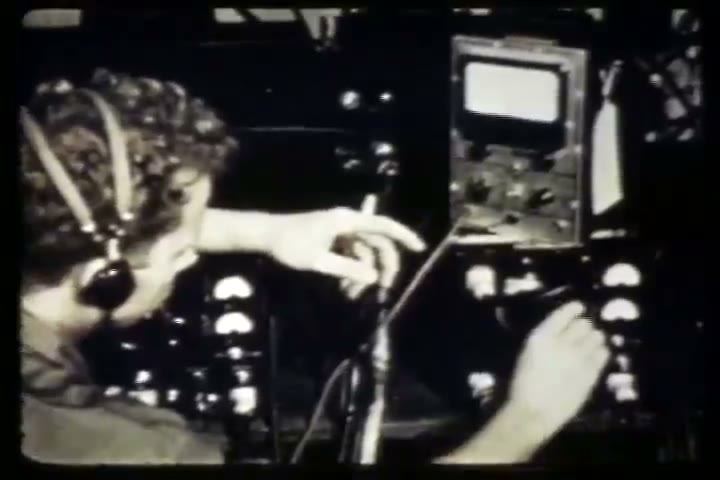
Declassified test footage depicts an environment of exhaustive technical calculation. In Operation Sandstone documentation, the narrative centers heavily on the stabilization of zero-island sand with cement to protect sensitive instruments and the deployment of the Hartman Line along radial intervals. Technicians calibrated free-piston gauges, audio limiter discriminators, and oscilloscopes inside shipboard workshops aboard vessels such as the USS Albemarle, while using tin foil shields on switches to mitigate thermal radiation.
“One vital phase is measurement of blast, as an index to weapon behavior… 38 members of the group will measure blast velocity and duration of positive and negative pressures generated by the explosions.”
Similarly, records from Operation Greenhouse emphasize diagnostic sophistication on Parry Island, where plastic balloons suspended blast gauges and automated photographic emulsions tracked invisible nuclear particles. Official film records present these equatorial sites as orderly extensions of university campuses, showing scientists hand-carrying apparatus through restricted security gateways under strict exclusion protocols.
However, the critical investigative value emerges when evaluating what official cameras systematically omitted. While footage highlights the physical majesty of detonations like X-ray, Yoke, and Zebra, or the four-mile-wide fireball of the Castle thermonuclear tests climbing five miles high within forty seconds, operational documentation acknowledges catastrophic containment and forecasting breakdowns.
During Operation Castle, the unexpected high yield of thermonuclear devices combined with winds shifting 10 degrees less favorable than forecast produced severe radiological contamination across downwind atolls. The visual record foregrounds firing bunkers on Enyu Island and diagnostic arrays of 12 evacuated pipes, but archival reports reveal that heavy fallout descended directly onto inhabited zones:
“The unexpected high yield caused significant fallout to occur on Rongelap Atoll 110 miles distant, on Rongerik 150 miles from Bikini, and on Utirik 280 miles out.”
The logistical response—documented in written task force summaries rather than cinematic montage—required emergency naval deployments. While 28 military personnel on Rongerik were evacuated via air starting at H plus 28 hours, native populations faced delayed removals. Approximately 150 residents of Utirik and the community of Rongelap were evacuated days later by naval destroyers originally assigned to cordon security, after which radiation survey teams returned to analyze contaminated water and soil samples.
The visual archives thus present a profound dichotomy: camera lenses remained fixed on blast wave propagation, crater formations, and shock revetments, insulating domestic viewers from the human dislocations and radiological contamination unfolding beyond the exclusion fence.
Transparency, Archival Provenance, and Legal Basis
The source documentation underlying this investigation comprises official military records, task force technical reports, and archival motion pictures held by the National Archives and Records Administration (NARA) within Record Group 374 (Records of the Defense Atomic Support Agency) and Record Group 077 (Office of the Chief of Engineers), alongside related historical compilations in Record Group 48 and Record Group 153.
Under 17 U.S.C. § 105, visual works and documentary motion pictures produced by officers or employees of the United States federal government as part of their official duties are not subject to domestic copyright protection and reside in the public domain. These historical records, accessible through official repositories and preserved collections on Wikimedia Commons under public domain and CC0 declarations, serve as critical primary evidence for ongoing public inquiries into Cold War military testing and atmospheric contamination.